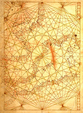
This first portulan chart in Arabic translated Pedro Vesconte’s signed and dated 1321 chart of Western Europe.
Exactly when and why the translation was made remains unclear.
The area appearing in this first portulan chart covers Europe and part of the Western Mediterranean .
View Arabic Portulan Chart in a larger map